Geotechnical Analysis
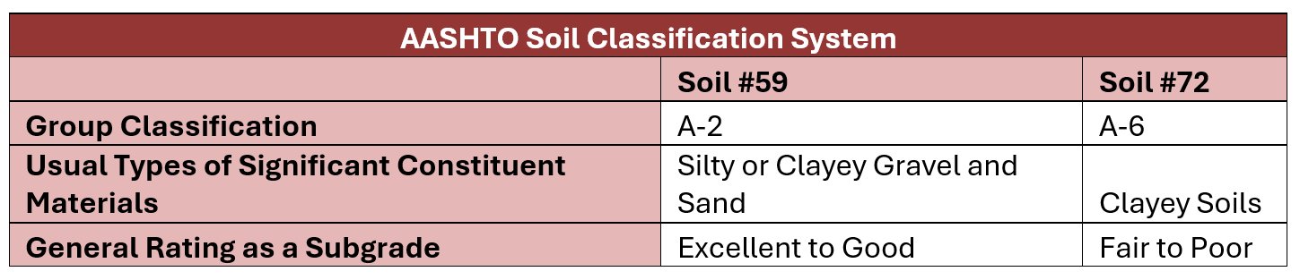
Soil Suitability Analysis
The suitability of the soil present at the site was determined using the USDA Web Soil Survey Data. Since the WSS provided the AASHTO classification, this information was used to determine whether the current soil is a suitable subgrade for the road design. The table below details the soil classifications.
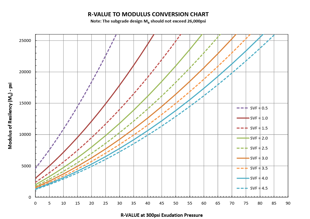
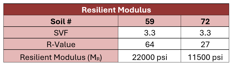
Resilient Modulus Determination
Since the proposed project is for a road instead of a building, the resilient modulus was determined in place of the bearing capacity. As stated in the ADOT Road Design Manual, the resilient modulus needs to be determined when designing a road with flexible pavement. The image below shows the graph that is used determine the Resilient Modulus. The table below show the values determined from the graph.
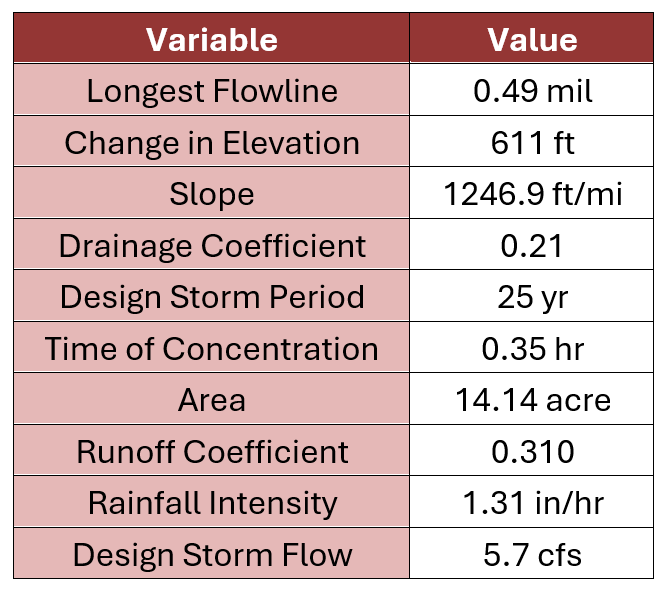
Hydrologic Analysis
Hydrologic analysis was performed for this site to determine the watersheds in the project parcel, in order to calculate the peak flow at the lowest point of the site as well as to manage surface flow into neighboring parcels. This included delineating watersheds, determining drainage and runoff coefficients, calculating the time of concentration, and determining the peak flow using the rational method. The table shows a summary of the determined values.